

By Charles Pitts

IRVING, Texas : Caterpillar Inc. (NYSE: CAT) has finalized the acquisition of Skycatch, a specialist in AI-driven spatial data and computer vision, in a strategic move to integrate high-frequency “digital twin” technology into its global mining ecosystem.
The deal, announced Tuesday, July 7, 2026, positions the heavy equipment giant to offer near-real-time 3D mapping and terrain analysis across its Cat MineStar and RPMGlobal platforms. By embedding Skycatch’s automated drone-mapping and AI analytics directly into its technology stack, Caterpillar aims to bridge the gap between mine planning and field execution, particularly for its rapidly expanding autonomous fleet.
Financial terms of the transaction were not disclosed. However, the acquisition is widely viewed as a critical step in Caterpillar’s “Autonomy 2.0” roadmap, focusing on sub-centimeter site precision and predictive operational modeling.
The Tech: Why Digital Twins are the New Gold Standard
For decades, mine site mapping was a slow, intermittent process involving manual surveys or occasional flyovers. The Skycatch acquisition changes that paradigm by introducing high-frequency, high-precision spatial data capture that can generate a near-real-time digital twin of an active mine site.
More Read
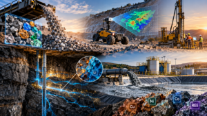
Skycatch’s proprietary SkyVerse and SkySight engines use computer vision to process terabytes of data on the edge. This technology converts 2D drone imagery into high-fidelity 3D meshes, achieving sub-2 centimeter accuracy. By integrating these models into NVIDIA Omniverse, Caterpillar can create live-synced simulations that allow operators to “see” site conditions years into the future or simulate the impact of weather events on haul roads before they occur.


“Integrating near-real-time spatial data into our platforms is intended to boost performance across operations using both staffed and autonomous fleets,” a Caterpillar spokesperson noted during the announcement. “The goal is to improve safety, productivity, and predictability by ensuring every machine on the site is working off the same, most current map.”
More Read
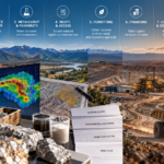
Key Data Points: The Skycatch Impact
| Feature | Traditional Methods | Skycatch-Enabled CAT Systems |
|---|---|---|
| Mapping Frequency | Weekly or Monthly | Multiple times daily |
| Precision | 10–20 cm | Sub-2 cm |
| Processing Time | ~3 hours (laser scan) | 10–15 minutes (AI-edge) |
| Data Utility | Historical record | Real-time operational guidance |
| Fleet Integration | Manual updates | Automated sync to MineStar |
Why It Matters: Boosting Autonomous Fleet Precision
The primary driver behind this acquisition is the increasing demand for autonomous mining solutions. As companies like Rio Tinto, BHP, and Newmont push for 100% autonomous haulage in certain pits, the margin for error in terrain data has vanished.
Autonomous trucks rely on highly accurate digital maps to navigate haul roads, avoid obstacles, and optimize fuel efficiency. If a haul road develops a minor slump or a bench profile changes after a blast, traditional mapping might not catch the change for days. This can lead to slower truck speeds or even system shutdowns for safety “exceptions.”

With Skycatch technology, the mine site is continuously re-mapped. The digital twin reflects the site as it exists now, allowing the autonomous dispatch system to adjust truck paths and speeds dynamically. This “tighter loop” between reality and simulation is expected to reduce operational downtime and significantly lower CO2 emissions by optimizing material movement.
2026 Outlook: The Future of AI in Mining
As we look toward the remainder of 2026 and into 2027, the Caterpillar-Skycatch deal signals a broader industry shift: the transition from “Big Iron” to “Big Data.”
Industry analysts expect that 2026 will be the year where “Digital Twins” move from a buzzword to a standard operational requirement. We are likely to see similar M&A activity as other equipment manufacturers, such as Komatsu and Epiroc, scramble to bolster their spatial AI capabilities.
For investors and operators, the focus will remain on how these digital integrations translate to the bottom line. Caterpillar’s integration of Skycatch into RPMGlobal planning tools suggests a future where mine plans are not static documents but living, breathing algorithms that adapt to daily geological and operational shifts.

Strategic Implications for the Industry:
- De-risking Exploration and Expansion: Enhanced 3D modeling allows for better volume calculations and more accurate copper M&A strategies, ensuring that companies pay for the actual ore in the ground, not a geological estimate.
- Safety and Compliance: Automated drone surveys remove humans from high-risk areas, such as highwalls and blast zones, while providing “laser-scan-level” accuracy for tailings dam monitoring.
- ESG and Decarbonization: Precision mapping reduces waste-rock movement. In an era of lithium supply chain volatility, operational efficiency is the quickest route to margin preservation.

Conclusion
The Caterpillar-Skycatch acquisition is more than a simple technology bolt-on; it is an admission that the future of mining is software-defined. By owning the data capture layer, Caterpillar ensures that its machines are the smartest on the market, capable of navigating a “living map” that evolves with every bucket of ore removed.
As critical mineral demand continues to ramp up, the ability to operate with sub-centimeter precision will separate the Tier 1 operators from the rest of the pack. For Caterpillar, the “digital twin” is no longer a luxury: it is the operating system for the modern mine.