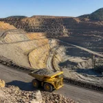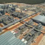


Heli-portable diamond drilling expands the Danvers copper system across remote Nunavut terrain.

By Charles Pitts
White Cliff Minerals has expanded the drilled copper-bearing trend at the Danvers 1 prospect, part of its Rae Copper Project in Nunavut, Canada, to approximately 4.75 kilometres. The result marks a 480% increase from the roughly 820 metres tested during the company’s 2025 program and shifts the exploration question from whether Danvers hosts a significant copper occurrence to how much of the broader structural corridor can be demonstrated as continuous, coherent mineralisation.
The expansion was driven by regional step-out drilling along the Teshierpi structural corridor. Among the most important results was hole DAN26035, drilled more than 2.5 kilometres northeast of the Danvers 1 core area. It returned 24.75 metres at 0.43% copper from 110.5 metres, including 5 metres at 1.21% copper.
That intercept is not the highest-grade result from the latest campaign. Its importance lies in its location. Mineralisation at that distance from the original drilling confirms that the copper system is not confined to a compact zone around the historic Danvers prospect. It also provides another data point for White Cliff’s structural interpretation of the Teshierpi corridor, although the spacing between holes remains too wide to establish a resource-quality model.
More Read

The significance of a 4.75-kilometre trend
A change from 820 metres to 4.75 kilometres represents a 5.8-fold expansion in the length of the tested footprint. In percentage terms, the increase is approximately 480%.

That distinction matters. The 4.75-kilometre figure describes the distance over which drilling has intersected copper mineralisation along the interpreted structural corridor. It does not represent a continuous orebody, a mineral resource, or a mineable envelope.
White Cliff’s latest announcement describes the northeastern drilling as regional in nature, with holes generally spaced between approximately 300 and 670 metres along strike. At that density, individual intersections can demonstrate that a favourable geological environment persists across a large area, but they cannot yet define the width, dip, grade distribution or continuity needed for resource estimation.
More Read

The company’s interpretation is based on several recurring geological features:
- The Danvers 1 prospect sits on a southeastern splay of the regional Teshierpi Fault.
- A magnetic low can be traced northeast from the core area.
- Copper sulphides occur in disseminated form within basalt, in vesicles near flow tops, and in quartz-carbonate-copper sulphide veins.
- Wider magnetic responses appear associated with more developed fault breccias.
- Narrower parts of the corridor can still host vein-dominated copper mineralisation.
This model is important because it gives the next drilling phase a predictive framework. The objective is no longer simply to test a long geophysical line. It is to determine where structural dilation, brecciation and favourable host rocks combine to produce thicker and higher-grade zones.

Bornite and other copper sulphides are being used to refine the geological interpretation, while laboratory assays remain the definitive grade measure.
What the latest holes show
The northeastern step-outs produced a mixture of broad, moderate-grade disseminated mineralisation and narrower, higher-grade vein-related intervals.
| Drill hole | Location or context | Reported copper intersection | Interpretation |
|---|---|---|---|
| DAN26027 | 225m northeast of DAN25020 | 17.0m at 1.41% Cu and 12g/t Ag from 194m | Stronger-grade mineralisation close to the Danvers 1 expansion area |
| DAN26031 | A further 1.1km northeast | 14.5m at 1.49% Cu from 166.5m, including 3.0m at 3.96% Cu and 18g/t Ag | Confirms higher-grade copper well beyond the original core |
| DAN26033 | Northeastern expansion | 34.0m at 0.18% Cu from 136m; 12.0m at 0.42% Cu from 204.5m | Broad disseminated mineralisation across the corridor |
| DAN26035 | More than 2.5km northeast of the Danvers 1 core | 24.75m at 0.43% Cu from 110.5m, including 5.0m at 1.21% Cu | Extends the tested copper trend to its current 4.75km scale |
The strongest evidence for a potentially repeatable system comes from the combination of location and grade. DAN26027 and DAN26031 returned copper intervals around 1.4% to 1.5%, while DAN26035 demonstrated that mineralisation continued farther northeast even as the structural zone appeared to become narrower.
The results therefore support two interpretations at once. First, the Teshierpi corridor can host meaningful copper mineralisation over a substantial distance. Second, grade and width may vary materially along the structure, meaning that the eventual economic significance will depend on identifying the thicker and better-mineralised segments rather than simply extending the strike length.
Why bornite-rich mineralisation matters
White Cliff has reported a copper sulphide assemblage dominated by chalcocite, bornite and chalcopyrite. In the northeastern holes, mineralisation is more commonly associated with planar quartz-carbonate veins, while the Danvers 1 and Danvers 3 areas include more substantial fault-breccia styles.
Bornite is a copper-iron sulphide often associated with relatively copper-rich parts of a hydrothermal system. Its presence can be geologically significant because it may indicate a favourable sulphide assemblage and help distinguish mineralised structures from barren fault zones. At Danvers, bornite-rich material is also relevant to the company’s effort to understand how mineralisation changes along strike and between breccia-hosted and vein-hosted settings.
That geological significance should not be confused with an economic conclusion. Mineral abundance observed in drill core is not a substitute for laboratory analysis, and visual estimates cannot establish grade, recovery or payable metal. White Cliff is awaiting assays for hole DAN26041, where more than 40 metres of copper-sulphide-bearing core was observed. The company has specifically cautioned that visual observations should not be treated as a proxy for assay results.
The pending result could help determine whether the sulphide-rich section between existing holes represents a stronger local zone or part of a broader mineralised envelope. Until those assays are returned, the interpretation remains provisional.
Infill drilling changes the purpose of the program
White Cliff has fast-tracked infill drilling along the Danvers 1 northeastern extension. This is a meaningful shift in exploration strategy.
The first phase of regional drilling was designed to test whether the magnetic and structural corridor carried copper beyond the known prospect. Infill drilling will be designed to answer more specific questions:
- Is the mineralisation continuous between the widely spaced holes?
- What is the true orientation and thickness of the copper-bearing structures?
- Where do fault breccias broaden?
- Are the higher-grade vein zones linked to broader mineralised domains?
- Can grade continuity be demonstrated at a spacing suitable for an Exploration Target or future resource work?
The use of oriented diamond core is central to that process. Structural measurements from oriented core can help define vein orientations, fault intersections, breccia architecture and the direction in which future holes should be drilled. Scissor holes may also be required to reduce the risk that the existing drill direction is producing oblique intersections.
White Cliff reports that its 2026 diamond drilling used NQ2 core and an AXIS Mining Technology orientation system. However, the company continues to report the intersections as drilled widths rather than true widths because the geometry of the mineralised zones is not yet sufficiently constrained.

The next phase of drilling is intended to replace regional-scale evidence with closer-spaced structural and grade data.
The risks before any resource estimate
The 4.75-kilometre result is an exploration milestone, not a resource declaration. Several technical risks remain.
Continuity risk: The northeastern holes remain widely spaced. Copper mineralisation may persist along the corridor but could occur as disconnected shoots, narrow veins or irregular breccia zones.
Geometry risk: Reported widths are downhole intervals. Without reliable structural control, the true thickness of the mineralisation cannot be calculated.
Grade variability: The latest results range from broad lower-grade disseminated intervals to narrower higher-grade zones. A long mineralised trend does not necessarily translate into consistent grades or mineable widths.
Sampling and assay risk: Pending assays, including DAN26041, could alter the interpretation of the northeastern extension. Assay data, rather than core appearance, must establish the grade distribution.
Metallurgical risk: Earlier test work on Danvers material indicated strong copper and silver recoveries through conventional flotation, but those results were based on specific samples from the project. Additional variability testing will be needed to establish whether the northeastern mineralisation responds similarly.
Arctic development risk: Rae is located in a remote Nunavut setting. Any future evaluation would need to address seasonal access, logistics, water management, permafrost, infrastructure and permitting. Those considerations are distant from the current exploration stage but will eventually influence project economics.
White Cliff has also referenced a historic Danvers estimate, but that estimate is non-JORC compliant and should not be treated as a current mineral resource. The new drilling must be evaluated independently under modern reporting standards.
What comes next
The immediate priority is infill drilling between the regional step-outs, alongside additional drilling at depth and along strike. White Cliff is also expected to continue testing Danvers 2, Danvers 3 and Danvers 4, as well as analogous targets along the wider Teshierpi Fault Zone.
The decision point will come when the company can demonstrate not only that copper occurs over 4.75 kilometres, but that the corridor contains geometrically coherent zones with repeatable width, grade and geological continuity. That evidence would support a JORC Exploration Target and, subject to sufficient drilling density and confidence, future resource-definition work.
A quotable framework for assessing Danvers
Scale first: 4.75km confirms a district-scale exploration corridor, not a resource.
Grade second: DAN26027 and DAN26031 show higher-grade shoots beyond the original core, while DAN26035 extends the system farther northeast.
Geometry next: Infill and oriented-core drilling must establish true widths, dip and continuity.
Resource last: A compliant estimate requires denser drilling, validated assays, geological domains, bulk-density data and sufficient confidence in continuity.
The Danvers story has therefore entered a more demanding phase. Regional drilling has established that the copper system is larger than the 2025 footprint suggested. The next campaign must show whether that scale can be converted into a continuous geological model with the width and grade distribution required for a meaningful resource evaluation.
Sources: White Cliff Minerals ASX announcement; Mining News North report. Related context: Skillings copper coverage and recent copper exploration results.

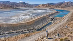
Remote Arctic terrain illustrates the scale and logistical setting of exploration at Rae.