

New EU-backed models reveal over 50% of the world’s mine sites missing from official records.
As the global energy transition accelerates, lithium, copper, and rare earths are under intense demand. Yet much of this extraction happens beyond the reach of government data. According to new EU-funded research, artificial intelligence and high-resolution satellite imaging are uncovering a vast “invisible half” of the world’s mining activity — and reshaping how the industry is held accountable.

AI Maps Mining’s Hidden Footprint
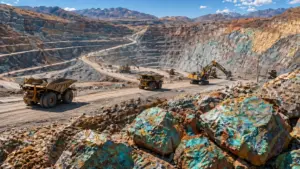
In one of the most comprehensive audits of global mining footprints to date, researchers led by Dr. Victor Maus of the Vienna University of Economics and Business compared 120,000 square kilometres of mine sites detected from satellite images with listings in the S&P Capital IQ Pro database. Their results were striking: over half of the visible mines lacked a corresponding record in corporate or government filings.
This “dark data” problem extends far beyond artisanal operations. Many small-scale and even mid-tier industrial sites operate without transparent permitting or production disclosure, particularly in parts of Africa, Latin America, and Southeast Asia.
For regulators and investors, the blind spot carries growing risk. Undocumented sites often coincide with biodiversity hotspots, Indigenous territories, and water-stressed basins, amplifying ESG exposure and potential future remediation costs.
The Sky Is Watching: Satellites and Machine Learning Join Forces
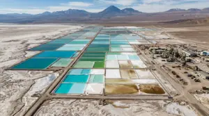
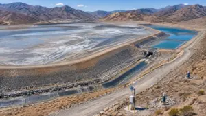
Today’s Earth-observation satellites — from the EU’s Sentinel constellation to German DLR radar sensors — can capture every mine’s signature: bare-earth clearings, tailings ponds, waste rock piles, and access roads. The challenge lies in turning terabytes of imagery into actionable intelligence.
More Read
That’s where AI-driven classification models step in. The Mine the Gap initiative, funded by the European Union, is building a real-time global mining database by fusing multispectral, radar, and hyperspectral inputs through machine-learning algorithms . Early pilots such as MineSegSAT have shown that AI can distinguish open-pit expansions or waste-dump growths with over 90 percent accuracy.

The implications reach far beyond compliance.
- Investors can verify production trends without waiting for quarterly reports.
- Governments can target inspections based on real disturbance data.
- Communities gain proof when mines encroach on protected areas.
By cross-referencing optical and radar signatures over time, the system detects incremental land-use changes invisible to traditional aerial surveys — a step toward genuine, data-driven transparency.
More Read

From Alaska to India: Seeing What Paper Missed
Recent studies illustrate the scale of under-reporting. In Alaska, a satellite survey found six-to-fourteen times more land disturbed by mining than official figures indicated. Meanwhile, start-ups such as KoBold Metals and Earth AI are already using remote-sensing AI to identify mineralization zones, claiming drill-success rates above 70 percent.
Governments are also adopting the technology. In Haryana, India, state authorities are integrating satellite imagery to track illegal sand and stone mining across district borders — an early example of “regulation via space”.
Risks and Ethical Boundaries
Despite its promise, AI-enabled monitoring raises new challenges.
- False positives: algorithms can mistake quarries or farmlands for mine pits, requiring ground-truth validation.
- Cost barriers: hyperspectral and radar data remain expensive for developing regulators.
- Sovereignty concerns: constant monitoring of national territory can provoke political resistance.
- AI’s carbon footprint: training complex models consumes significant energy .
Crucially, experts caution that transparency must not criminalize subsistence miners or marginal communities. A sustainable oversight framework demands local participation, data ethics, and fair transition planning.
Skillings Analysis
AI-satellite integration is fast becoming the new ESG compliance backbone.
- For producers: expect institutional investors to demand third-party satellite validation of ESG metrics.
- For suppliers: traceability platforms could soon embed satellite APIs to prove ore origin.
- For policymakers: the technology provides the factual foundation missing from years of voluntary disclosure.
If “Scope 3 emissions” reshaped reporting in the 2010s, “Scope 0 visibility” — the physical footprint itself — will define accountability in the 2030s.
The Outlook: Mining in the Open
As 2025 closes and the EU’s Corporate Sustainability Reporting Directive takes effect, the industry faces a new era where the sky doesn’t lie. The next phase of the energy transition will not only depend on who controls the world’s minerals — but who can see them.
For miners, transparency is shifting from reputational virtue to operational necessity. Satellites have become the industry’s mirror — and soon, every pit, dump, and tailings dam will be reflected in orbit.